Updated on June 26, 2013
Day 11 – Bruce’s Day Off
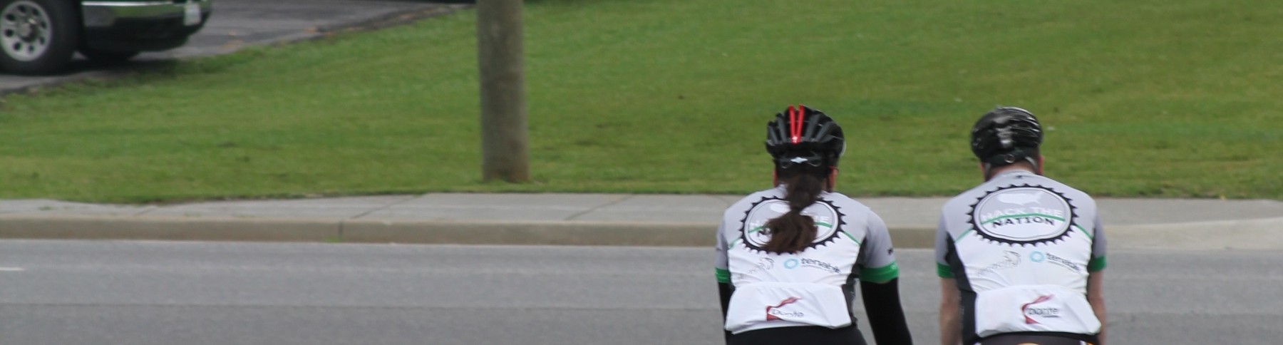
Fair warning – this post comes with lots of pictures of the Potter kids.
Today was an off day for me. Not by planning or choice, mind you. I’ve been pushing pretty hard the last week and a half to hit all the marks on the schedule. Yesterday was hilly and hot and I think I pushed it too far. I felt pretty lousy last night and it continued on till the morning. I was super tired, my heart rate was way off, and I felt generally off. Given that there’s nearly 3k miles left to go in this adventure, I decided discretion was the better part of valor and let JP ride solo today.
Honestly, it wasn’t a bad rest day to take. My mom and her side of the family are from this area, so we did a little sight seeing on the way to Bardstown, our next stop. Mom, expect a package in the mail 🙂
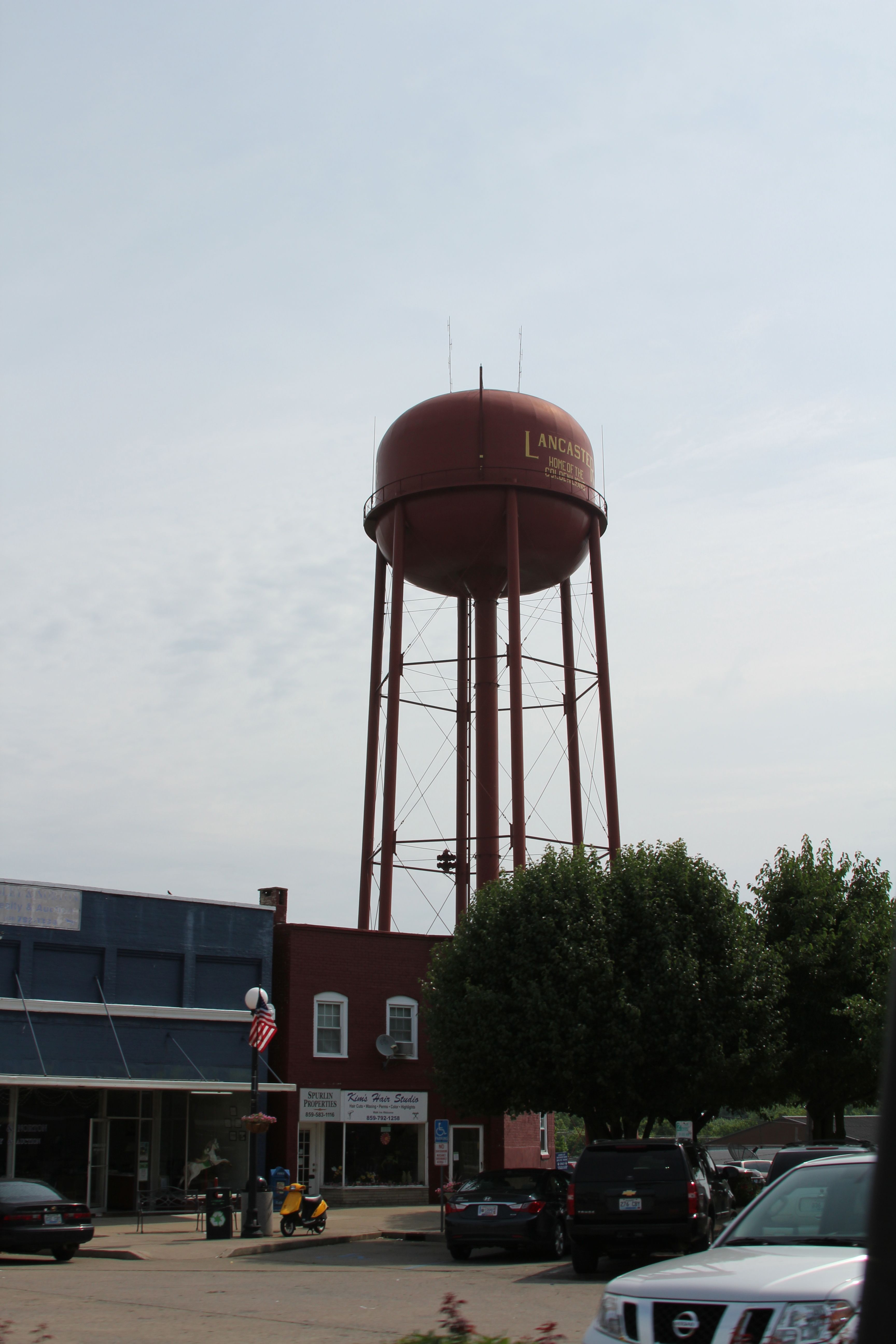
This is MUCH flatter country than what we just rode through so you can actually see things on the horizon. There are watertowers everywhere.
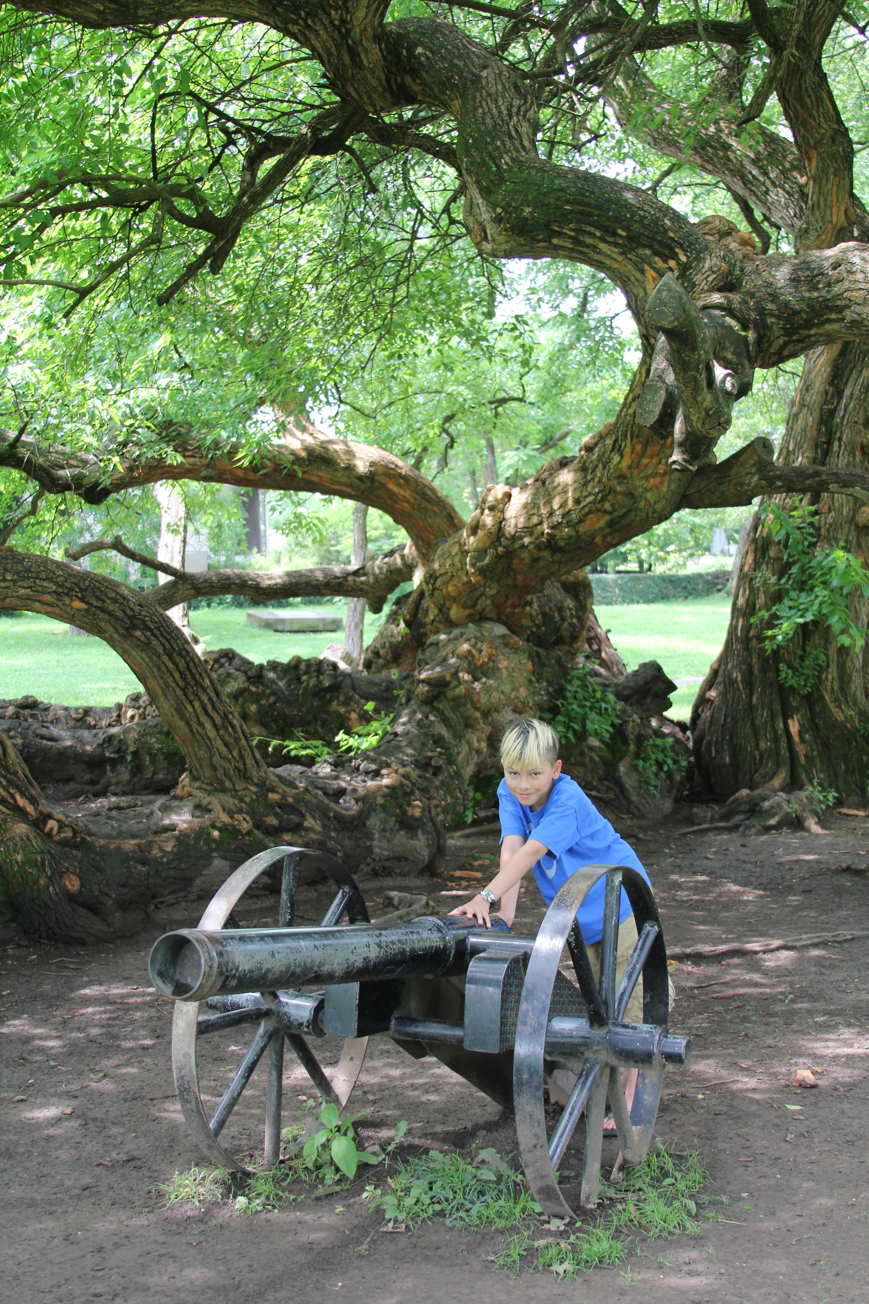
The Lincoln Heritage Trail also cuts through this part of the state. The Trail is a collection of Lincoln-related historic sites including the cabin his parents were married in (located in Harrodsburg KY).
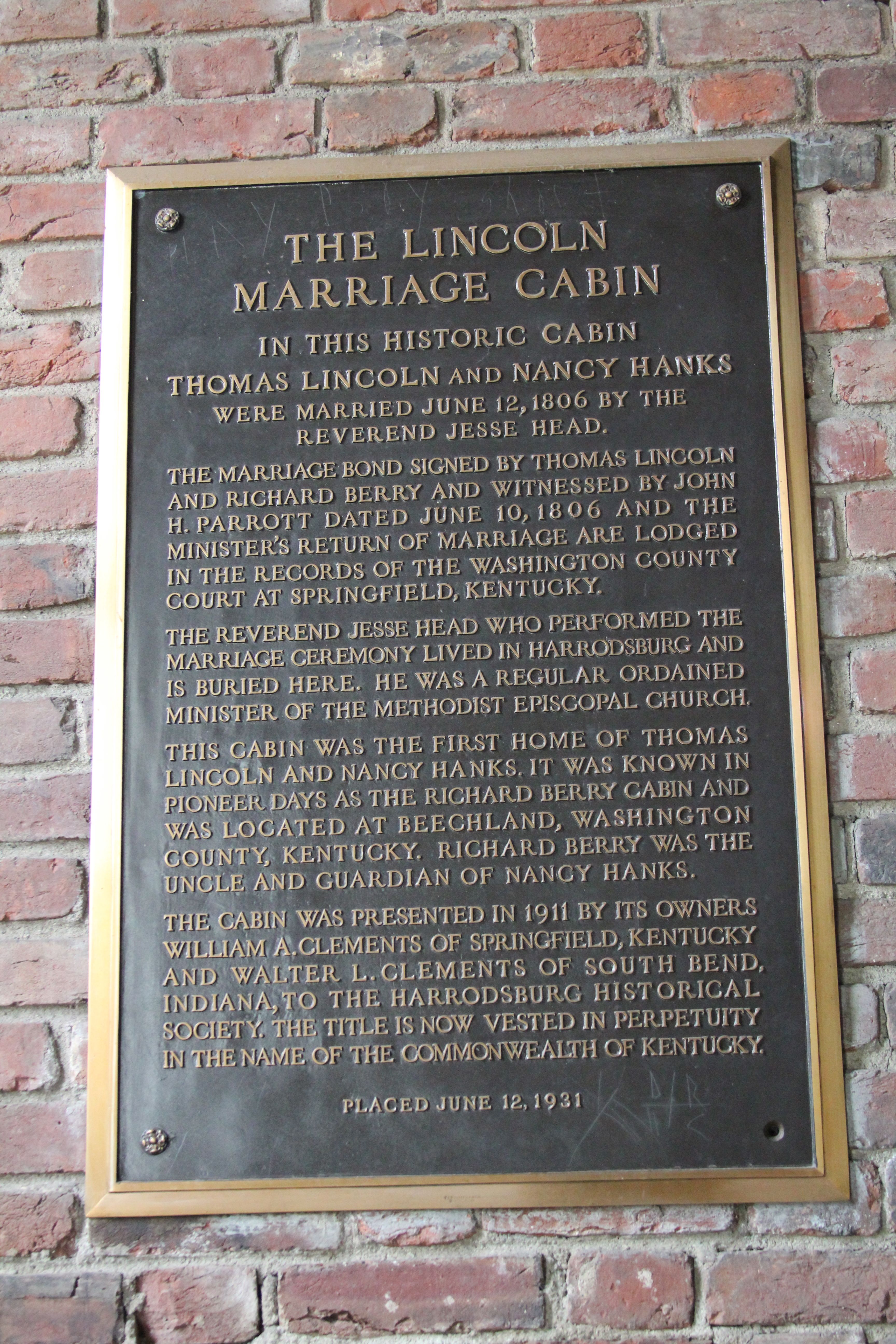
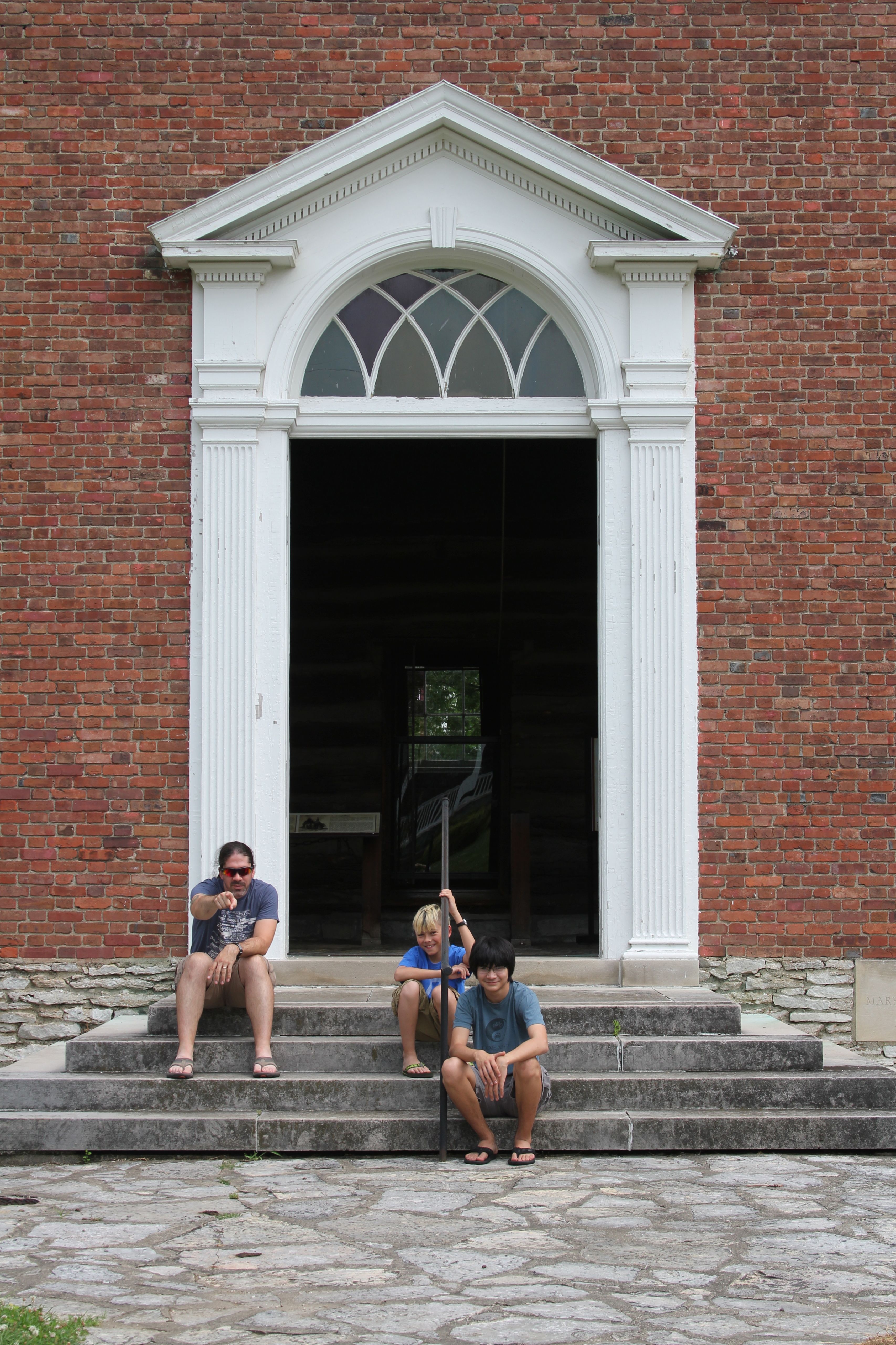
It should be noted that the cabin is preserved by placing it inside another building. “Buildception” as Terran put it. It’s hard to see in the photo below, but there’s a cabin inside that doorway behind us.
There was also a VERY large orange tree on the grounds. And a cannon. A full featured stop.
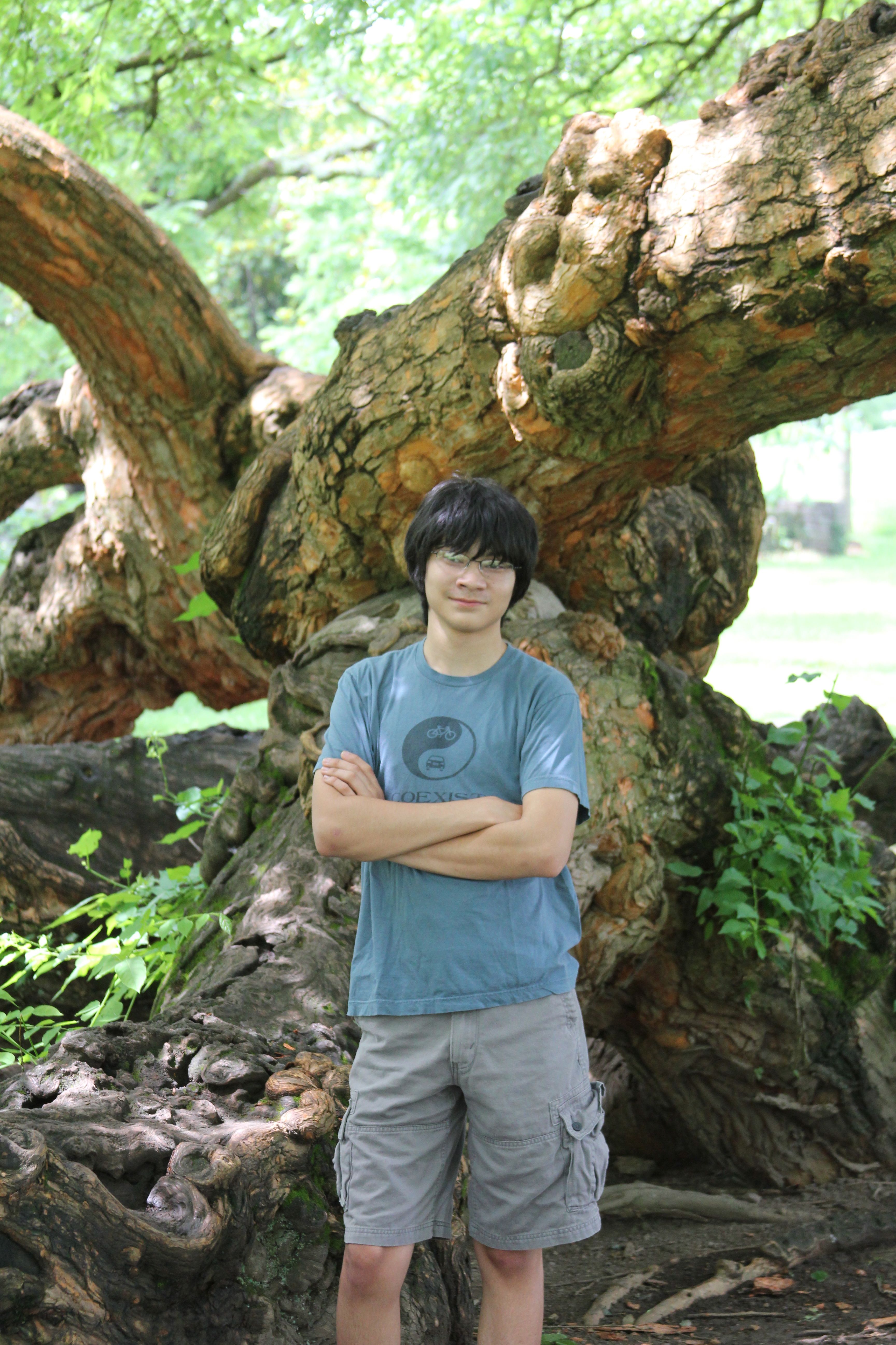
Terran doesn’t like having his picture taken. This was the best out of about 30 that Heidi took 😉
Daxton spent all his time trying to aim the cannon and saying “boom”. I think he understood what it was. Which is scary.
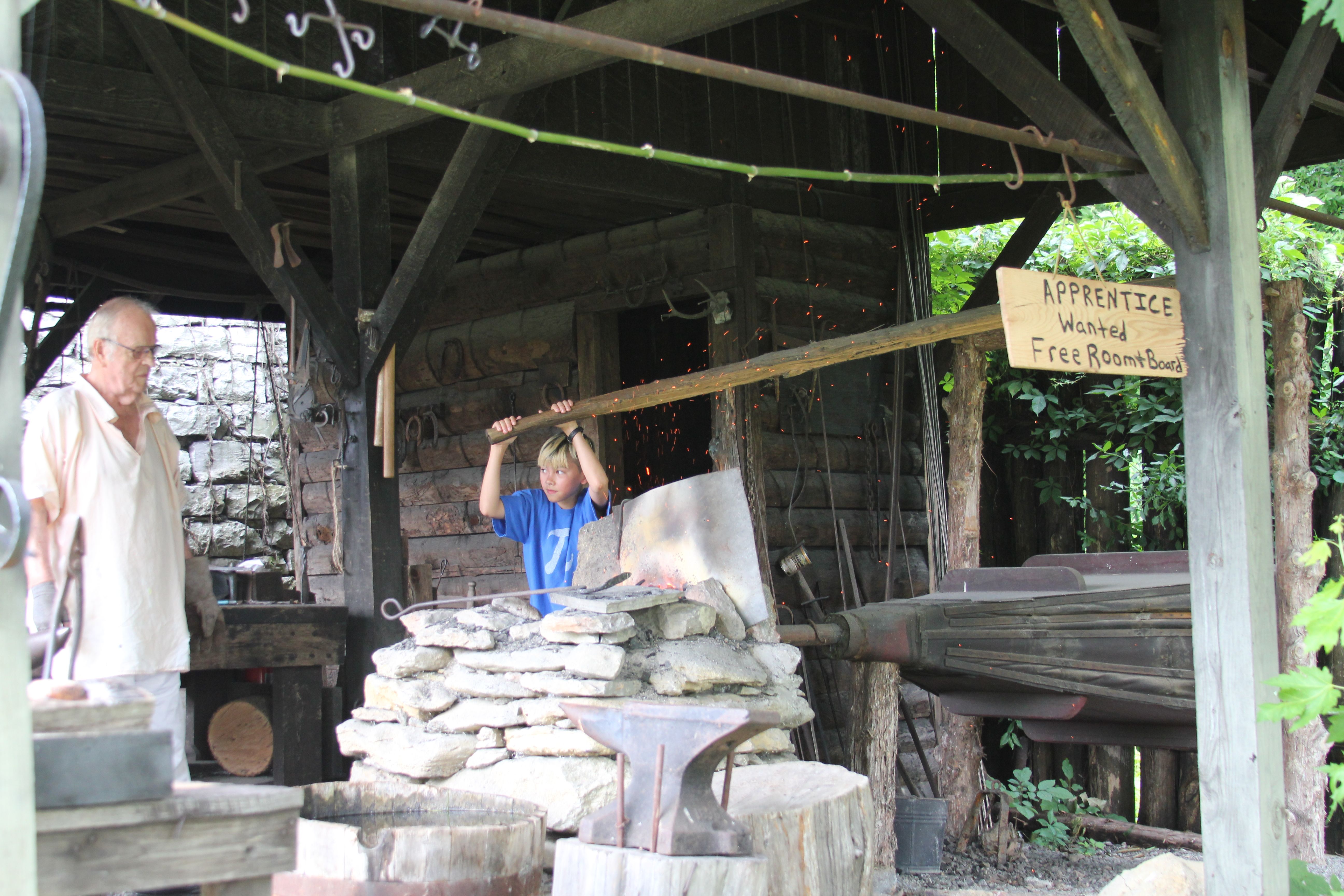
Also on the site was a recreation of Fort Harrod. Inside the fort they had people dressed in period outfits doing period things like making soap, making yarn, and blacksmithing. Bobby even got to help the blacksmith and keep his creation.
Also, they had the loudest sheep in the world inside the fort. There wasn’t a plaque or anything, but it was loud enough I’m sure the critter would have broken any pre-existing records.
It should be noted that Kentucky State Parks are awesome. Between the Buckhorn Lake Resort and the Fort Harrod park, it seems that other states could learn a lot from the Kentucky parks service.
Finally, some frivolity. Terran tries to photobomb everyone. So I got him back.

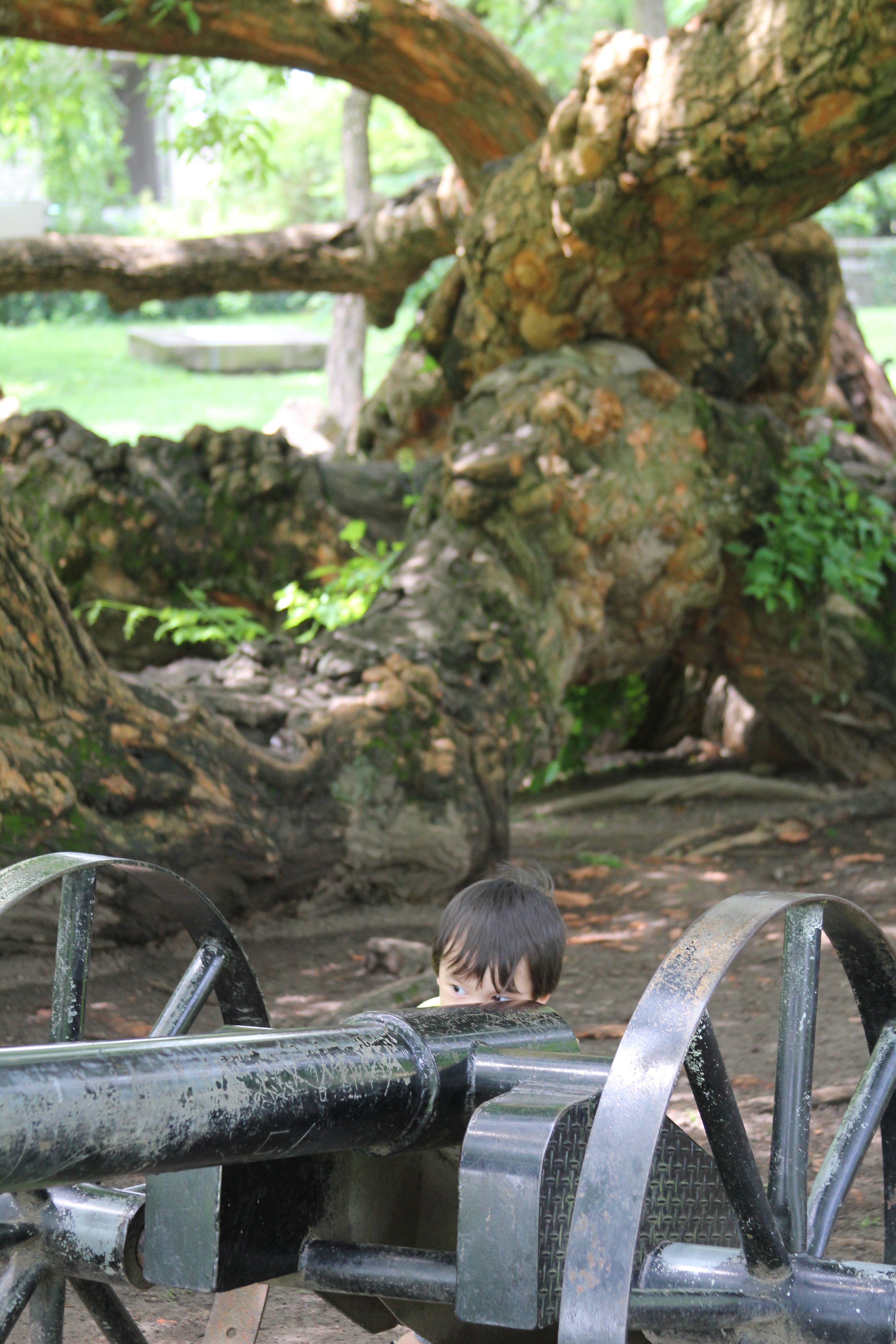
And Dax got sick of all the pictures.

That’s it. Hopefully I’m back to normal tomorrow. I’m going to get to sleep early and try to hit the road as fresh as possible. It’s a short day with only one real climb so I think it should go well. We’ll see.
Updated on June 25, 2013
Week 1 review Part 2 – Wow I’ve learned alot
Picking up where I left off yesterday – some more serious cycling stuff. The other major things I have learned this week can be put in 3 categories – climbing, nutrition, and pacing. Let’s start with nutrition.
Nutrition
Twice in the past 10 days, I’ve found myself in a caloric deficit. I am not going to drill too deep into the science of maintaining energy as a 6 day on one day off cyclist – but basically you will burn more calories during your ride than you can comfortably consume. After that – as you start to approach a 1500-2000 calorie deficit, something called bonking happens.
This is bad for two reasons. 1.) you are done for the day. You basically have to bust your ass to go faster than 8mph because your body is simply out of energy to burn. 2.) This actually sets you up for a bad day tomorrow as you now have to replenish calories up to baseline in your body, then you need to eat enough to get ready for the next day.
If you are burning ~3000 calories just on a ride then another 2500 per day – you need to make up 5500 calories in less then 12 hours. At 500 calories per hour – this is not really possible and you go into the next day at a deficit. This plain sucks. I can’t describe the feeling – but it’s not fun. You basically have to not ride, or ride very little the next day to get back to baseline and to get ready for the ride the day after. So – yea this has happened to me twice. Combined with mad climbing.
Climbing
So let’s say that Rochester, NY where I live has a few “anthills” and that’s about it. You need to ride well over 50 miles to actually get 2-3K elevation, and then – it’s spread out over that distance. Well folks, welcome to the Blue Ridge/Appalachains/Ozarks of VA/KY/MO. Suffice to say that if I climbed more than say… 6000 feet all year, I’d be surprised. Well, week one alone, I climbed over 25,000 feet. This is no joke. Now, these aren’t 5000 foot days over 70 miles, these are proper Tour de France caliber climbs. Turns out climbing 1000 feet in 3.5 miles if fracking hard, especially with a pitch averaging 6-8% (12-14 degrees). Now – not that I didn’t suffer up to the top – I did, but on some days – burning 1000 calories in an hour during the beginning of the ride – they just kicked my ass.
My first and longest climb – up the Blue Ridge Parkway on July 18th, was my longest climb ever in my life. It was 2500 feet up in about 10 miles. Then 2 days ago, I climbed Hayter’s Gap (aptly named) at 1000 feet in 3.5 miles (the climb I mention above) and then yesterday – 2 climbs (700 feet in 2.5 miles) and 600 in 1.5 miles) just took everything out of me. Now – I weigh a few more pounds than I’d like to and every extra pound you need to pull up a mountain means more work – but I honestly think my muscles just need time to repair (hence the day off today) that was proudly earned. I really wish I could do every mile – but man the climbing is unforgiving.
I have to thank my man Dave Bonan who messaged me on Facebook and reminded me to scoop up with my legs while going up hill – this tip single handedly got me up the Blue Ridge parkway and subsequent climbs. Thanks Dave!
Pacing
Let’s wrap up with pacing. So – when riding in Rochester – it’s not really a big deal to power up a “anthill” as you will reach the top in 20-30 seconds on most climbs – way before you get anerobic. Not out here – even on the quick up and downs – I naturally want to burst of these hills with the logic of the faster I’m over it the less I have to be on the uphill. Well – you can’t really do that with a marathon. I have had to learn to force myself to be ok with starting a hill at 6-8 mph and just slowly powering up it. I notice my HR stays down or at least it’s longer til I have to get off my bike for a moment, and I’m generally more successful getting up the mountain.
So a huge thanks to Bruce, Heidi, and my dad – Art, for putting up with my learning curve as I start to get comfortable being in the saddle everyday and behaving the way I should on the road, and with my eating as I start to transition in to an amateur long distance cyclist. Here’s to hoping that this is the first of many multi thousand mile journeys!!!
Updated on June 25, 2013
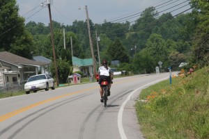
Day 10 – Buckhorn Lake to Berea
By the end of today, we had officially left the mountains of eastern Kentucky. But boy, do I feel like it took something out of me.
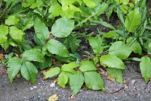
We left Buckhorn Lake State Park this morning in the MCC to get back to the route. Upon pulling over to the side of the road to get out, I darn near stepped in poison ivy. It turns out, there’s a LOT of poison ivy on this route. Every time you stop, you have to check to make sure you’re not about to step in poison ivy… or a snake – there are a lot of them around as well.
Today was punishing. It was hot and humid… and there was an incredible amount of vertical. 5.5k’ of vertical in just over 70 miles. And much of that climbing was at 10%+ grades. I was definitely gassed towards the end of the ride.
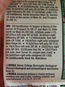
When I created the GPS route the night before, I had only taken the route to the city line for Berea. It turns out, Berea is actually a large town. Well, there aren’t that many people, but it’s wide. Our hotel is on route, so Heidi took a picture of the map directions and sent them to me so I could navigate in. She’s so awesome 🙂
Also, today was the first day we had to do any real RV specific maintenance. The “black water” tank was almost full. For those that don’t know what black water is in the RV context, that’s the holding tank for the waste from the toilet. Grey water is sink/shower water, in case you were wondering. So we found the local RV park, and for the low low price of $5, we got to empty our tanks. Bobby got to help. He is clearly thrilled.
As a side note, we see a lot of roadkill on the rides. Today the roadkill du jour was turtle. I saw an unbelievable number of dead turtles on the road. I almost racked up one myself on a downhill. I’m happy to have avoided that disaster (for both the turtle and myself)
Updated on June 25, 2013
Week 1 Review Part 1 – Wow I’ve learned alot
Well, a little more then one week under the belt, and holy crap – I’ve learned alot about my body, my bike, and climbing hills.
Let’s start out with getting on the road. I’ve finally gotten a routine down that for the most part I’m ready with in 5-10 minutes of when I say I will be. Being packed in the car and on the bike before 7am isn’t easy. Now that the Stanley Cup Playoffs are over, this should be a bit easier as I’m trying to get to bed by 10pm each night. (Not my style.) I’m considering shipping some stuff back home, as I’m a chronic over packer (the Potters have already shipped stuff home.
Next up – electronics. I can’t even begin to describe how grateful I am that I bought a Garmin 810 a month ago. (Learn all about it here.) First – I’ve never had turn by turn directions for riding before. I’ve always tried using my iPhone and gone as far as buying the full Wahoo suite of products (iPhone mount & ANT+ sensor + external battery.) This ended up being fail for a few reasons – one big one was that one of my gmail accounts requires a phone password and while – yea it’s a pretty good idea – if your phone locks while you are riding entering a PIN to see your speed/stats/etc is kinda lame. In addition – when going on long-ish rides – say 40 miles – I start to battle the battery gods. Between GPS, grabbing sensor data once per second, and just normal activity (incoming email, and whatever else an iPhone does to suck down your battery) I’d be down to like 30% half way through my ride. The only solution I found that saved my battery was to turn off cell service – but what good is that. Anyhoo – the Garmin has been brilliant once I got the Lower 49 states maps loaded (more on that in a bit). So – turn by turn directions – brilliant! Bruce maps out the ride the night before – emails me a GPX file, I load it and off we go. If we run into a problem with a confusing turn or anything – we have full maps right on us, as well as auto re-routing to get us back on route. Finally – after a 70 mile ride I still had 56% battery left. The only thing this thing doesn’t do is tell me the weather – we’ll it does if I let it pair to my phone via bluetooth – but I’d rather have a charged phone in case I need it than the weather as we check it pretty often.
OK – so there are 2 ways to buy maps for your Garmin 810. The easy way (which Bruce did) is to buy the SDCard with the required maps preloaded at Performance Bike or REI, plug it in and you are done. Well since I don’t have either of those around – and I bought my Garmin very shortly before my trip, I chose the download route. So for $59.99 you insert a SDCard in your Garmin, then you download it and you are done. Turns out – this is kinda true – you just have to wait like – overnight… I had to start the download, configure my laptop not to go to sleep, and wait overnight. They finally updated (after like 5 tries – even one with Windows) and I had the maps.
Also – between Bruce and I – we are seeing some elevation differences of about 10-15 percent. I need to look into if I need to calibrate mine or something.
In Part 2 of this post – I’ll talk about what I’ve learned regarding Nutrition, Climbing and Pacing myself.