Posted on September 12, 2014
Hack the Hat 2014
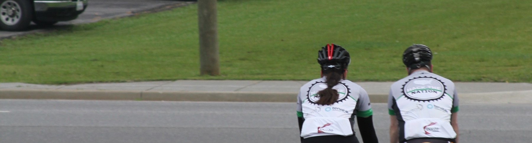
Last year Bruce and JP rode about 4-5K miles each. This year Bruce has ridden about 40 and JP about 400. That doesn’t mean we won’t bring bikes to Derby and go for an AM ride! We hope to get 15-20 riders! Bring your kids! We will wait up for them!
Once again – Saturday will be the best day. A lot of folks will be in training Friday morning and many will be hung over on Sunday morning. So here’s what we’re proposing… Rally in front of the hotel at 7:30am with your bike and we’ll head out for approximately 20 mile ride out and around Louisville. The sun rises at 7:36 on Saturday, so by the time we all get organized and on the road, it should be light out. We probably won’t make it back in time for the first talk on Saturday, FYI.
We’re not entirely sure of the route yet, but we’ll keep it under control with no brutal hills (does Louisville even have brutal hills?). This will be a no-drop ride, but hopefully we can keep a decent speed. In Vegas, the ride has split in to 2 groups of riders the last few years based on ability. We may end up doing that again here. We’ll see.
So bring your bike and helmet to Louisville. Don’t feel like transporting one? Looks like a few local places will rent bikes. Bike Courier Bike Shop and Wheel Fun Rentals are close to the hotel, but it’s not clear exactly what they’ll rent you. There are other LBS’s in the area that will rent as well. Google is your friend.
If you are thinking of riding with us, please hit up @cycle_override on Twitter or send us an email at [email protected] so we can gauge the size of the pack. Spread the word. The more the merrier.
BTW: The city of Louisville has a fantastic site set up to help guide local cyclists and lays out their plan for making Louisville bike friendly. Wish we’d see that from more communities.
Updated on August 5, 2014
2014 – 4th Annual Defcon Bike Ride
EDIT – The Defcon Bike ride has been moved to Friday Aug 8th at 6am. Meet at McGhies at 6-6:30am – and we hope to hit the road after getting everyone’s bike rentals sorted by 7am.
TLDR: TShirt Pre-Orders here. Ride with us at Defcon signup here.
Dust off your cycling shorts, get out the chammois butter, ice the water, it’s almost time for another Defcon Bike Ride in Las Vegas!
The date of this years bike ride is Aug 7, 2014 at 6am. This is Thursday of Defcon. We will meet outside the Rio at 5:30am by the valet. There will also be a contingent meeting at the Tuscany at 5:30 am.
Registration is here. This is just so we can get a count and capture if you want a tshirt. It will also give us your email so we can blast out any details needed pre ride, or at 5:25am on Aug 7th ![]() .
.
Here’s the deal – we have partnered again with McGhies Bike Shop in Las Vegas for our ride. Yes – they will throw your clipless pedals and seat posts on if you insist. They have 3 levels of road bikes: a ~$40 Cannondale Synapse, and a ~$100 Lance Armstrong starter kit road bike (think Madone.) There’s also a $125 level also.
Bike rental is first come first serve — there are about 18 $40 male road bikes and 5 female — after that it’s a hybrid or a $100 bike. You can always ship out your bike for about $100 each way on most airlines.
Here’s what YOU have to do:
You need to go here and reserve your ride. You will need to pay with a credit card. You should note anything special here and you should indicate you are reserving for the Defcon Bike Ride.
Here is what you should put in the comment box: (your own specs of course)
“Defcon Bike Ride
Size: 54 cm – will bring my own pedals
Need bike at 6am”
And for pick up:
Please select pickup at store – Las Vegas
Use this chart based on your height and inseam to figure out your size and fill the comment box out accordingly:

- From mcghies.com

You alone are solely responsible for your bike reservation. McGhies is aware that we are running this event and will support us, but it’s on you to make sure you are all set with a bike.
THE ROUTE
NOTE: This ride may be at a higher altitude than you are used to. (2600-3800 ft)
OK — last piece the route – you can see the route here. This is the same route as last year (and the year before). Basically the route is slightly uphill out – and mostly downhill back. It’s looking like we’ll have a car heading up the back. (thanks @myrcurial ) There may be a bigger loop for those interested – we’ll let you know soon (basically taking the scenic loop around and catching up w/the group on your way back) – but it will likely be unofficial.
We are looking for sponsors so let us know if you are aware of anyone interested in throwing in some schwag or some cash to help support this ride.
What do I do next?
Once you reserve your bike — all you have to do is wait for Defcon 21! Oh and keep riding!
Cheers!
The Cycle Override Team
PS if you have any questions — leave a comment so everyone can see the answer!
Posted on September 11, 2013
Hack the Hat v3 @ Derbycon
Fall is in the air. Days are getting shorter, leaves are starting to change colors… Must mean DerbyCon is right around the corner.
JP and Bruce are recovering from the epic 2600+ mile cross country ride this year, but they have time to hop on a bike at Derbycon!
It looks like Saturday will be the best day. A lot of folks will be in training Friday morning and many will be hung over on Sunday morning. So here’s what we’re proposing… Rally in front of the hotel at 7:30am with your bike and we’ll head out for approximately 20 mile ride out and around Louisville. The sun rises at 7:36 on Saturday, so by the time we all get organized and on the road, it should be light out. We probably won’t make it back in time for the first talk on Saturday, FYI. For sure, @gdead has to make it back by 11a, as that’s when his talk is.
We’re not entirely sure of the route yet, but we’ll keep it under control with no brutal hills (does Louisville even have brutal hills?). This will be a no-drop ride, but hopefully we can keep a decent speed. In Vegas, the ride has split in to 2 groups of riders the last few years based on ability. We may end up doing that again here. We’ll see.
So bring your bike and helmet to Louisville. Don’t feel like transporting one? Looks like a few local places will rent bikes. Bike Courier Bike Shop and Wheel Fun Rentals are close to the hotel, but it’s not clear exactly what they’ll rent you. There are other LBS’s in the area that will rent as well. Google is your friend.
If you are thinking of riding with us, please hit up @cycle_override on Twitter or send us an email at[email protected] so we can gauge the size of the pack. Spread the word. The more the merrier.
BTW: The city of Louisville has a fantastic site set up to help guide local cyclists and lays out their plan for making Louisville bike friendly. Wish we’d see that from more communities.
Updated on August 12, 2013
Day 57 – San Francisco
We’re done. What a day. It’s certainly satisfying to make it all the way to San Francisco (and a bit surreal to be here). Tho, honestly, this was probably the most difficult day of the trip. Between the ride itself, the logistics, and just the duration, I’m totally wiped out. That said, Heidi won’t let me go to bed until I write the post, so here it is 😉
It was a beautiful day in Sacramento. JP and I looked particularly photogenic in the morning sun.

The plan for the day was to SAG up to Winters, ride to Vallejo, catch the 2pm ferry to SF, then ride the last 6 miles from the SF ferry terminal to the Warming Hut at the Golden Gate Bridge. We decided to leave out of Winters to make sure we made it to Vallejo in plenty of time for the 2pm ferry. We were shooting for a 1pm arrival, and we got there at 1:02. Not too bad from a planning perspective.
A few days ago Bobby decided he wanted to ride that last 6 mile segment in SF with us. Figuring it was mostly bike path and bike lanes, I agreed. He’s been really excited about it, and the first thing he did this morning when he got up was to put on his biking jersey. Then, after JP and I hit the road, he got his bike prepped with Terran and rode it around the parking lot to make sure everything was ready.

The ride out of Winters started with a bit of a horse race. The route we were on is apparently popular with the local riders. We hooked up with a small group of riders and put the throttle down for the first 5 miles or so. We ran a nice paceline scooting along at ~19mph while we wound our way through orchards and vineyards.
We met up with the MCC and Art 23 miles in to the ride. We refilled bottles, grabbed a quick bite, and were optimistic about the second 23 miles we had left. Unfortunately, mother nature (and the local geography) had something else in mind. The wind really picked up and JP and I fought a 15mph headwind for a good chunk of the ride. Also, there was a bit more climbing than we expected coming in to Vallejo so that cut our pace down too. Luckily we had allocated enough time to get in to the Ferry terminal so it wasn’t an issue.
On the way in to town, we took ~5 miles of a bike trail that went up and over the pass in to town. We swapped positions with another cyclist on the trail a few times, and finally met up with him at the bottom of the hill/end of the trail. The rider asked me “When you reach the bottom of the trail, what do you do? I always turn around, but there’s got to be more riding.”
I respond… “Well, we’re going to go up and around Columbia Parkway, turn right on Georgia, get on the ferry to San Fran, and then ride to the Golden Gate Bridge to finish a 2 month long cross country bike trip.”
“Oh. Huh. I don’t think I’ll do that.” with smiles all around.
Anyhoo, JP and I met up with Heidi in the MCC at the Vallejo ferry terminal. Art had already left for SF to do some sight seeing, and after a quick conversation, Heidi, Terran, and Dax were on their way to SF as well. JP, Bobby, and I enjoyed the midday sun and some chicken tenders while we waited for the ferry.
Terran took the camera while Heidi drove through town. He managed to catch a shot of Cupid’s Span with the Bay Bridge in the background.

He also got a picture of the Ferry Building… pretty good shot from the car.

JP, Bobby, and I tracked the MCC via our mobile app. Heidi was definitely battling Sunday SF traffic and barely beat us to the bridge before we made landfall.
At the Ferry Terminal we were met by Tom Tufts, another Tom (that Heidi and I went to school with) and his girlfriend. They were the first of our welcoming committee and were riding with us to the bridge. Also, I’ve been worried someone was going to wreck during this trip… turns out, it was Tufts on his way to the Ferry Terminal. He took a spill… which I appreciate. It spared me or JP having to do it instead.
The ride to the Warming Hut was crazy. There are a TON of people on bikes and walking around SF on the weekends. Plus, cars. I was a bit nervous about Bobby making it to the bridge, but he did a fantastic job. He handled himself well, especially when we got behind about 50 tourists who were all over the trail, snapping photos, and generally not paying any attention to those around them.
So just before 4pm, the whole group of us rolled up to the Warming Hut.

And here’s the obligatory handshake. Looks like we just signed a treaty or something… assuming heads of state sign treaties while wearing spandex shorts.

There were even more folks waiting for us at the Hut. It was really fantastic to have that kind of greeting. It’s pretty amazing to see friends and family waiting for us after this adventure. It was certainly heartwarming and a welcome sight after 2 months on the road.

All the cousins even had a chance to play together. I assume they’re all sleeping soundly as they really had a good time together both at the bridge and then afterwards at Heidi’s sister’s place.

And just so we have some proof, here’s us with the Pacific in the background. No it’s not photoshop. Yes, we made it.

Even more friends caught up with us as we made our way back to the car. And with unplanned timing, one of Heidi’s oldest friends happened to be driving over the golden gate just as we were arriving and we were able to see him as well. Just amazing.
So that’s it. There will be some follow-on posts regarding lessons learned, advice for anyone else trying to do this, gear reviews, etc. But this is the last of the daily updates. Thanks to EVERYONE that followed us throughout this trip. I was stunned by the number of people who I spoke to over the last few weeks who have been reading this blog and keeping track of our ride. Your support means a lot to JP and I. And a HUGE thanks to Art, Heidi, and the boys for all they did for us this summer. This ride wouldn’t have been possible without them and we can’t thank them enough.
Till the next ride…